
The United States was hit by historically cold and windy Winter weather with a rare mid-latitude mid-continent cyclone, one that would undergo a process of rapid intensification called Bombogenesis, or Bomb Cyclogenesis. The event was termed “Winter Storm Elliott.” This is a collection of some of the news stories, video and images about the storm and some of its effects. The image above depicts the extent of the cold on Thursday, Dec. 22 @ 11:00 am ET.
The storm began in the Pacific Northwest on Dec. 20 with up to 2 feet of snow in the Cascade Mountains with temperatures in the teens and 20s in Seattle. It moved through the Rocky Mountains and into the Plains on Dec. 21. Temperatures dropped 30 to 50 degrees in Wyoming and Colorado, with Denver dropping to -24, setting a local record of a 37° drop in one hour. On Dec. 23 the storm went through bombogenesis over the Great Lakes region, with the low-pressure centered over Sudbury, Ontario, Canada at ~7:30am Dec 23rd. During this storm temperatures dropped dramatically across a large swath of the United States, as depicted in the maps below. Freezing temperatures were experienced as far south as the Gulf of Mexico, with below freezing temps from Corpus Christi, Texas to Gainsville, Florida.
Post Contents:
Extent of cold during Winter Storm Elliott
There are three maps included here. All three were compiled by the Webmaster. These maps show the temperature, wind direction and velocity as provided by the National Weather Service. The first two maps are of temperatures experienced during the event. A third map was created after the event to show what more normal temperatures look like. The first map is from December 23 at 10:45 pm MT, the second is from December 25 at 12:15 am MT, and the third is from December 29 at 11:30 pm MT.
Each map has color-coded circles on each temperature reading. Color-coded lines have been added connecting temperature regions, showing the extent of temperature bands. A legend is provided indicating color-temperature associations.
These are meant to show the extent of the cold as it reached all the way down to the Gulf of Mexico and stretched in the western United States from the Rocky Mountains eastward to the Appalachian Mountains. These are not meant to show the record setting cold temperatures but rather the general extent of the record-setting cold.

Extent of cold during Winter Storm Elliott – Uncropped Versions of Dec. 25 & 29
The maps above are all cropped to make comparison between maps easier. Uncropped versions of the original maps (Dec. 25 & 29) provide information about a larger region but are harder to compare. I’m providing those below because they show conditions in the surrounding regions which is interesting to look at.
Maps Source:
- NWS Weather & Hazards maps by Weather & Hazards Data Viewer, National Weather Service, National Oceanic and Atmospheric Administration.
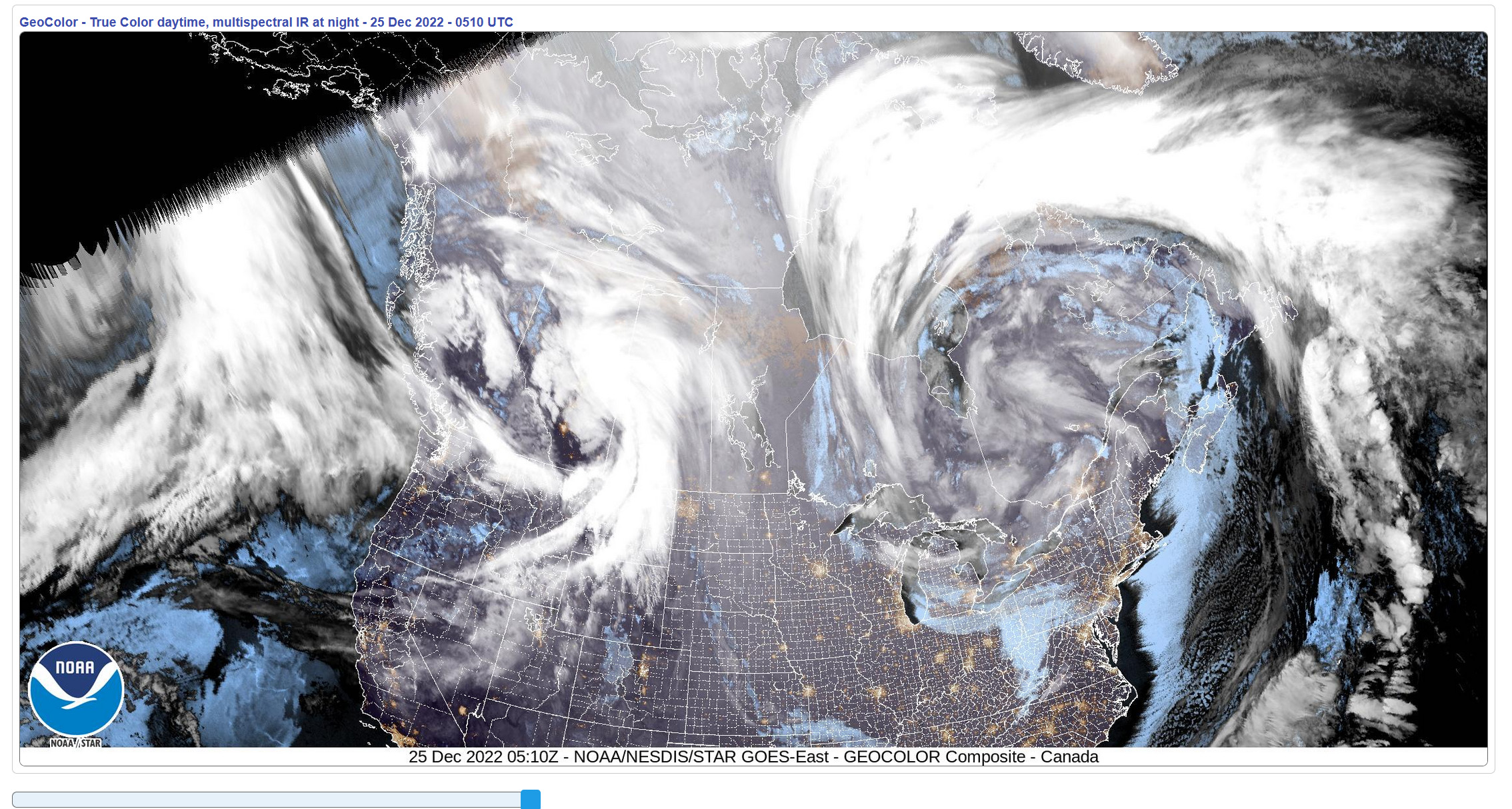
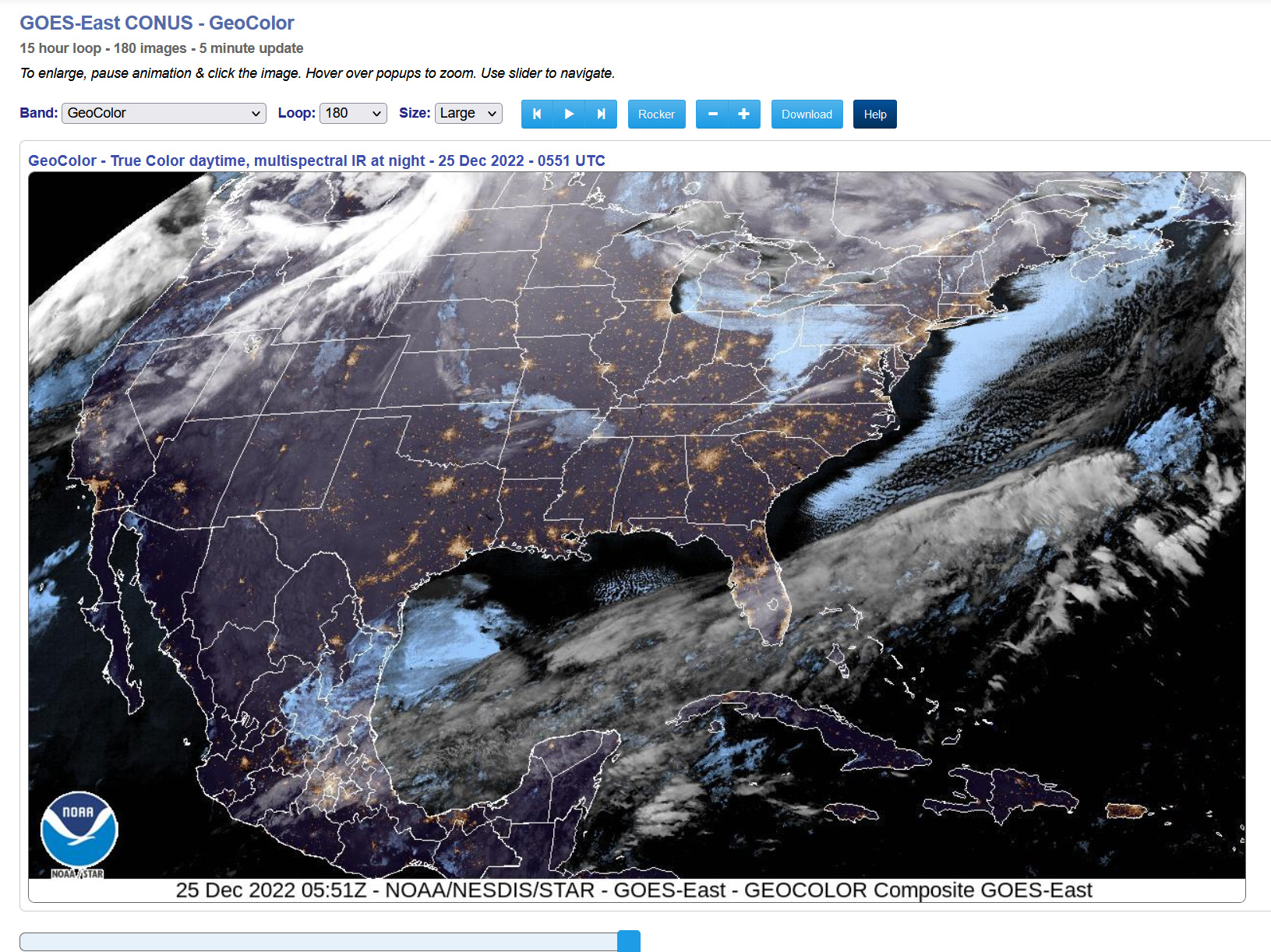
Satellite Images
Imagery showing the view from the GOES-East satellite, both Canada (upper) and Continental United States (lower) views on Sunday morning at 12:20 AM Central Time , December 25, 2022.
Location of the low pressure on December 23, 2022.


Various Articles & Photo Essays:
- “Winter storm to trigger dangerous blizzard, high winds and Arctic cold” by By Matthew Cappucci and Jason Samenow, The Washington Post, December 21, 2022.
 Washington Post")
- “Here Comes a Bomb Cyclone to Ruin Christmas: The storm’s scale and severity is unprecedented. Almost everyone in America, and a fair few in Canada, will feel its force” by Amanda Hoover, WIRED, December 22, 2022.

- “What Is the Polar Vortex? And Other Cold-Weather Climate Questions: As much of the United States plunges into a deep freeze, scientists continue to debate how rapid Arctic warming is playing a role.” by Henry Fountain, The New York Times, December 24, 2022.

- “Western New York Buried Under Worst Storm in Decades, Travel Disrupted Across the U.S.:
Awful conditions stranded motorists and knocked out power across a swath of the U.S., as parts of the country unaccustomed to frigid weather dealt with record lows.” The New York Times, December 25, 2022.

- “In Much of the South, Subfreezing Weather Crippled Water Systems: The bitter cold had left the region by Wednesday, but myriad broken pipes, disrupted municipal water systems and widespread aggravation remained.” by Rick Rojas, Alyson Krueger and Sydney Cromwell, The New York Times, December 28, 2022.

- “Photos: Winter Storm unleashes severe weather across North America” by Washington Post Staff, The Washington Post, December 29, 2022.


- “What is a bomb cyclone? Here’s how they’re formed and what to know.: These are the most intense mid-latitude storms and earn the designation ‘bomb cyclone’ because of an especially rapid drop in air pressure” by Scott Dance and Matthew Cappucci, The Washington Post.
")
 Washington Post")


")
See also in Internet Salmagundi
Other Sources
- “Winter Storm Elliott Intensified Into Bomb Cyclone With High Winds, Blizzard Conditions, Flooding” by weather.com meteorologists, The Weather Channel, December 24, 2022.
- “Winter Storm Elliott Intensified Into Bomb Cyclone With High Winds, Blizzard Conditions, Flooding” by weather.com meteorologists, Weather Underground, December 24, 2022.
- “Winter Storm Elliott Leaves Dozens Dead” by Jan Wesner Childs, Weather Underground, December 29, 2022.
